22 Dec The Guide to Catching Native Yellowstone Cutthroat in Utah
By Hayden Cook – Utah Cutthroat Slam Assistant Program Manager, Utah Trout Unlimited
Utah boasts incredible destinations for anglers pursuing their Utah Cutthroat Slam, with remote creeks and stunning alpine lakes offering opportunities to get closer to completing the challenge. Among these destinations, the Raft River Mountains stand out as one of the most remote, housing Utah’s native Yellowstone Cutthroat Trout. In this article, I aim to provide an overview of all the creeks within the Raft River Mountains inhabited by Yellowstone cutthroat and offer advice for successful fishing in this region.
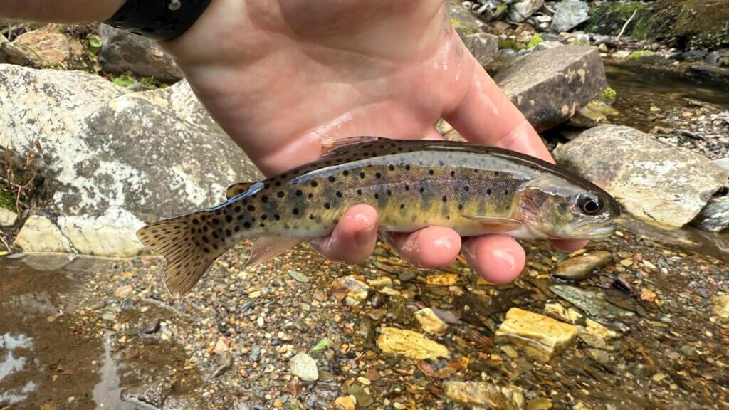
To understand the presence of Yellowstone cutthroat trout (YCT) in Utah, it’s essential to examine the drainage they inhabit. Historically, creeks on the north slope of the Raft River Mountains flowed into the Raft River, a tributary of the Snake River. Originating in Yellowstone National Park, the Snake River is home to native YCT. Over time, some YCT migrated into the headwaters of Raft River tributaries, where they remain today. Changes in water flow, climate, and agriculture have led most creeks in the Raft River Mountains to no longer connect to the Raft River, with YCT now permanently residing in individual tributaries. Despite challenges posed by introduced non-native fish and climate change, efforts by the Utah Cutthroat Slam and the Utah Division of Wildlife Resources aim to preserve these rare fish. The Utah DWR conducts population surveys of YCT in the Raft River drainage every five years, providing valuable insights for conservation efforts. And the catch information from anglers completing their slams helps give a view into the health of these populations as well.
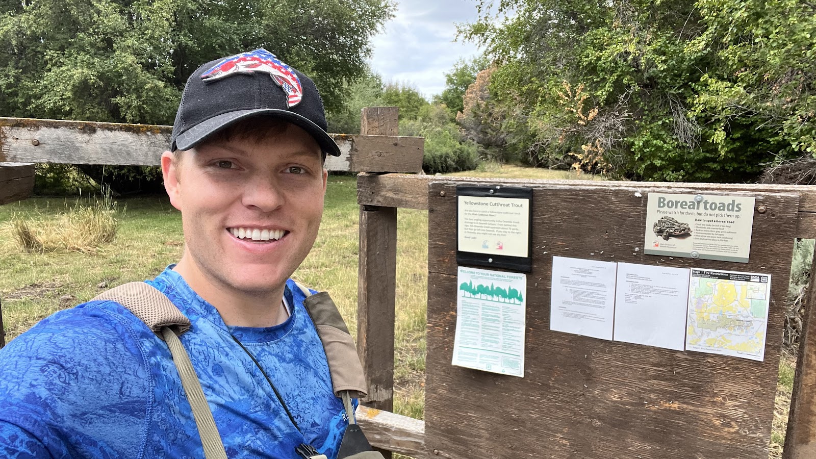
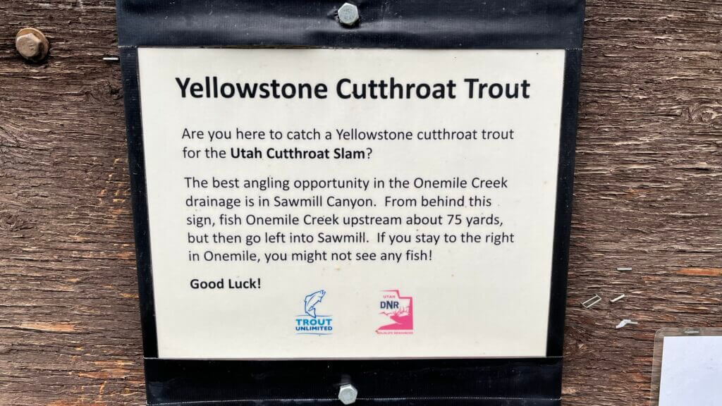
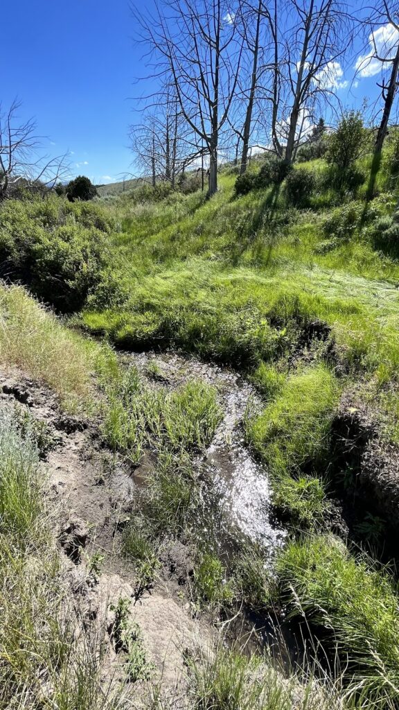
The first creek I will cover is Onemile Creek. Due to its location, it is one of the most popular streams for anglers to catch their YCT, since it is the closest creek to access if you are coming from I-84 near Snowville, UT. The road to Onemile Creek is gravel and dirt but is relatively tame and can be driven by pretty much any vehicle. When one reaches Onemile Creek, you are greeted with a small parking area and a Forest Service bulletin board (41.971509, -113.428260). This board contains a flyer mentioning the Slam and gives anglers advice for fishing here. From the parking area, Onemile Creek can be seen and heard babbling nearby and some may be lucky enough to catch their YCT within eyeshot of the road. But most will have to cross the fence and make their way up the Sawmill Canyon tributary stream feeding Onemile Creek.
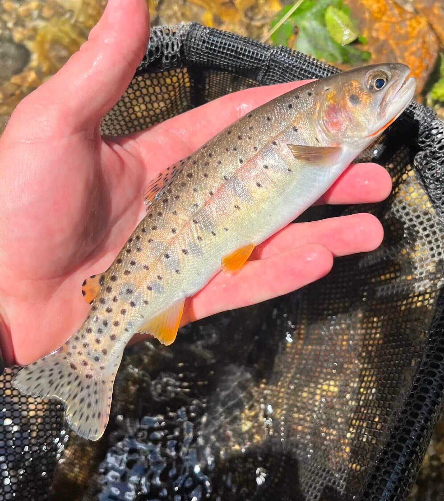
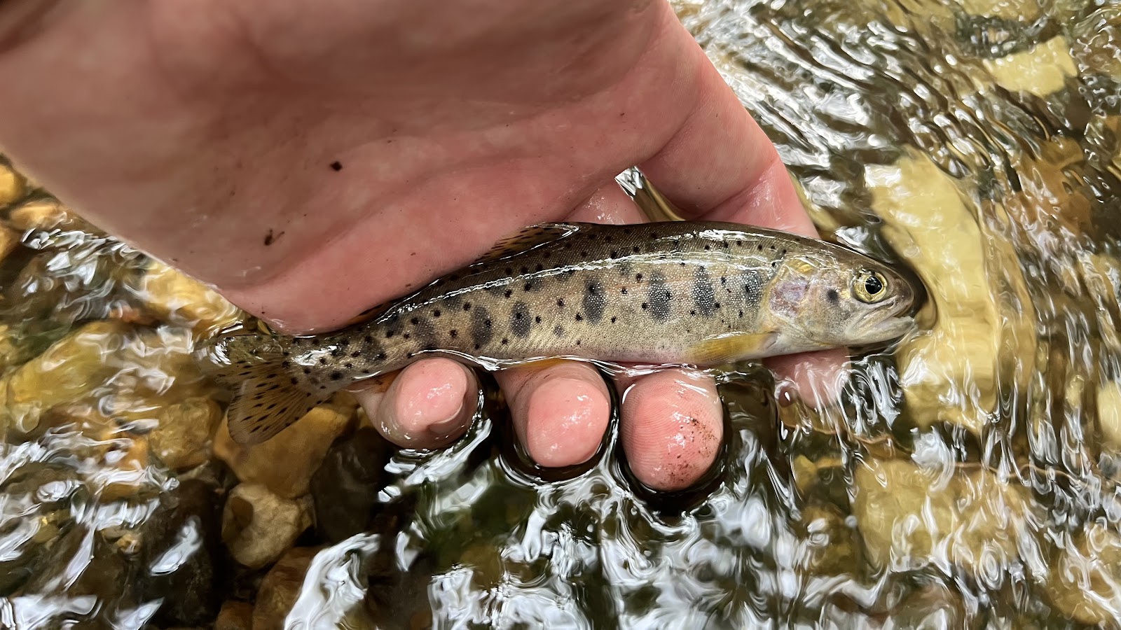
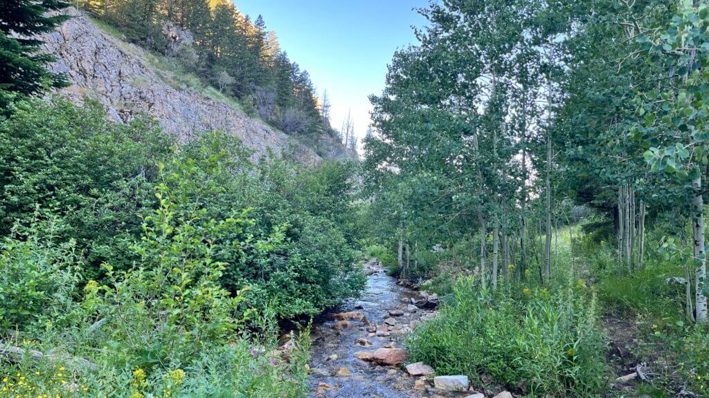
As you move up the creek into Sawmill Canyon, you may notice the vegetation begin to transition from oak brush and low tree cover to aspens and pine trees. These upper reaches may offer better fishing opportunities as they tend to see fewer anglers and have easier pools to cast to. So be willing to explore the length of Onemile Creek and the Sawmill Canyon tributary for success in angling here. Yellowstones are the only species of trout in Onemile Creek and Sawmill Canyon, but in the past 5 years they have experienced a decline in numbers and overall size of fish due to warm, low water seasons and failed natural spawning. Despite this, these populations typically rebound after cooler seasons with better snowpack. But as a note, be careful of which creek you fish past the confluence of Onemile Creek and the Sawmill Canyon tributary. If you stay to the right on Onemile Creek past the confluence, you might not see any fish!
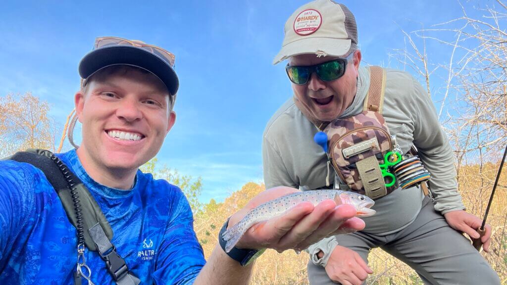
Before I move on to the other streams, let’s chat about the best ways to fish these creeks. Many anglers aren’t quite prepared for the challenge of tackling these small, bushy waters, and unfortunately, they often come away empty-handed. The prime time for fishing is generally through the summer, but you can still reel in some catches from spring (June or whenever runoff ends) to fall (October or before ice freezes over the creeks). It’s crucial for anglers to approach each creek stealthily and meticulously search every nook and cranny for these elusive cutthroat. Spotting the fish before they spot you is key. Sometimes you’ll catch them feeding from the water’s surface, while other times, they’ll be chilling in a cozy spot near an undercut bank. Polarized sunglasses are a game-changer for spotting trout.
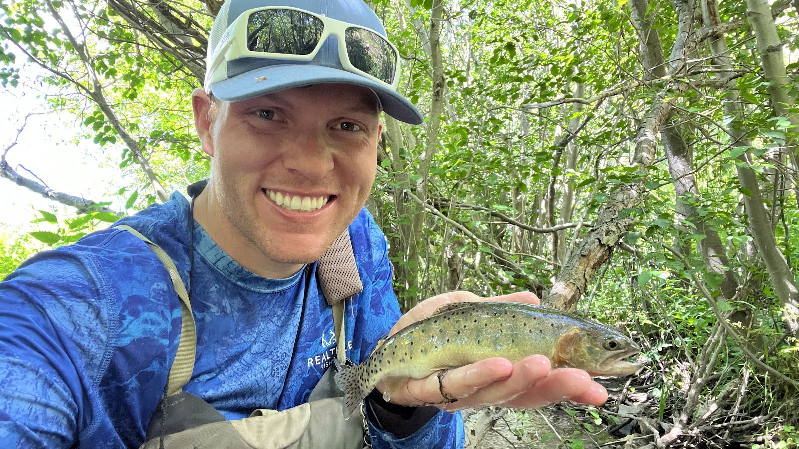
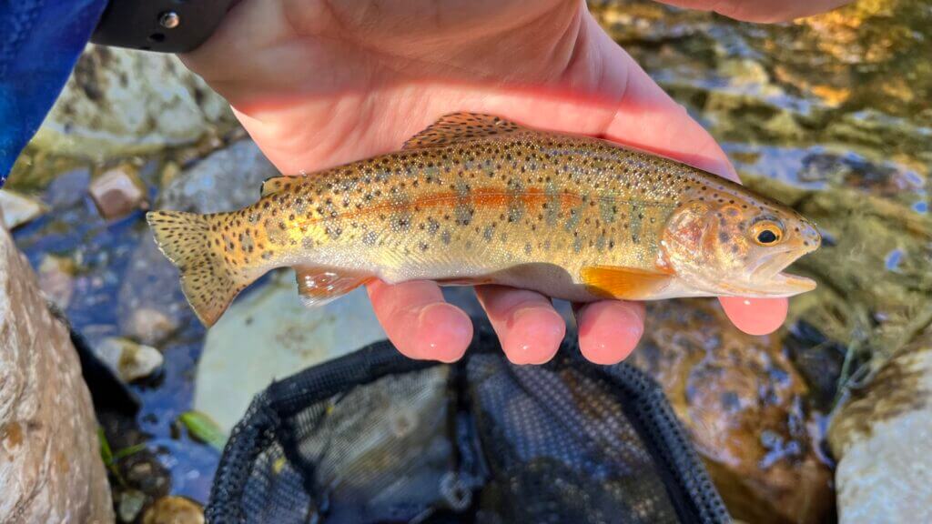
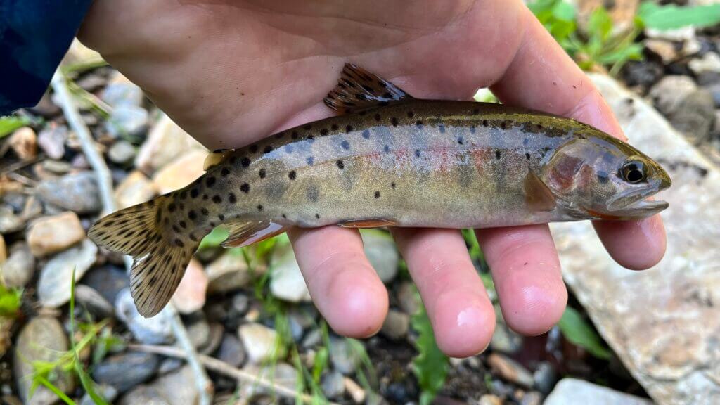
While you can catch cutthroat using any approved angling method, using a fly rod with small dry fly imitations of insects or bugs is often the most effective. I’ll even use a dry-dropper setup with a small midge or nymph only a few inches below my dry fly depending on the depth of the creek. The trout generally are desperate enough to go for any dry, but at times they will be more inclined to go for the dropper. I’ve seen some anglers show up with standard fishing rods and lures, but they usually don’t have much luck.
Even with a fly or tenkara rod, traditional casting might not work well depending on the surrounding vegetation and the fish’s location. You might need to get creative with your techniques. Bow and arrow casting can help get your fly exactly where you need it, and if your rod is long enough to reach the fish, dapping the fly can be another handy trick since fish often don’t notice the rod hovering above them, even if it’s only a few inches. I’ve even resorted to crawling on my stomach to sneak up on fish and position my rod tip and place the fly just right. My only caution is when you’re down on the ground, watch out for snakes!

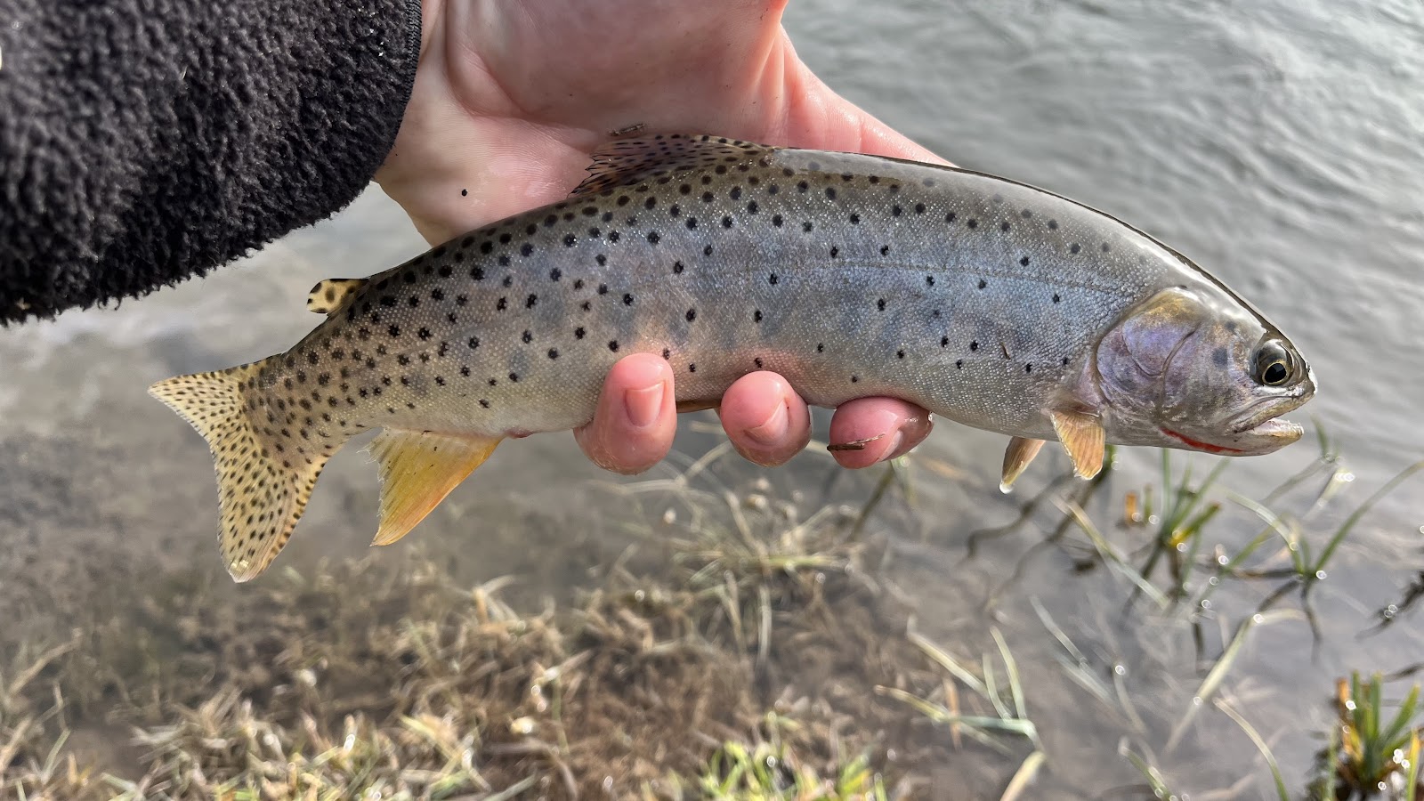
Let’s talk about Johnson Creek next, as it holds the reputation of being the most popular location to complete the slam. Electrofishing surveys have revealed that Johnson Creek and its tributaries have the densest cutthroat populations per mile, making it a prime fishing spot. However, don’t expect it to be a walk in the park, Johnson is still a brushy stream that requires precision casts and stealth. Johnson Creek used to be overrun by invasive brook trout, posing a threat to the native cutthroat holding out in the headwaters (Left Hand Fork Johnson Creek and Browns Canyon). Fortunately, through smart management and restoration efforts, the lower parts of Johnson Creek were cleared of these intruders in 2013-2014, allowing the Yellowstones to thrive again throughout the length of the drainage.
Accessing the creek requires navigating a slightly rougher dirt road, so it’s wise to have a vehicle with good clearance and tires. Once you pass the cattle guard and spot the Sawtooth National Forest sign (41.925754, -113.561880), you’re in fishing territory. While finding the perfect spots for fishing can be a challenge, the fish are there if you’re patient and stealthy. Further up the road, there will be some shallow water crossings that you should be aware of, but keep the dispersed camping areas along the road in mind, as there are some beaver ponds near some of them that may offer easier casting opportunities. If you have an AWD or 4WD vehicle, you may be able to access upper portions of Johnson Creek closer to the headwaters. You can even park at the confluence of Left Hand Fork Johnson Creek (41.885015, -113.541760) and hike up the tributary, even up into Browns Canyon, for additional angling opportunities. But be prepared for more dense brush along the way since it never really clears up. It’s worth noting that fishing tends to be easier downstream as summer progresses, so aiming for the headwaters earlier in the season might be more rewarding.

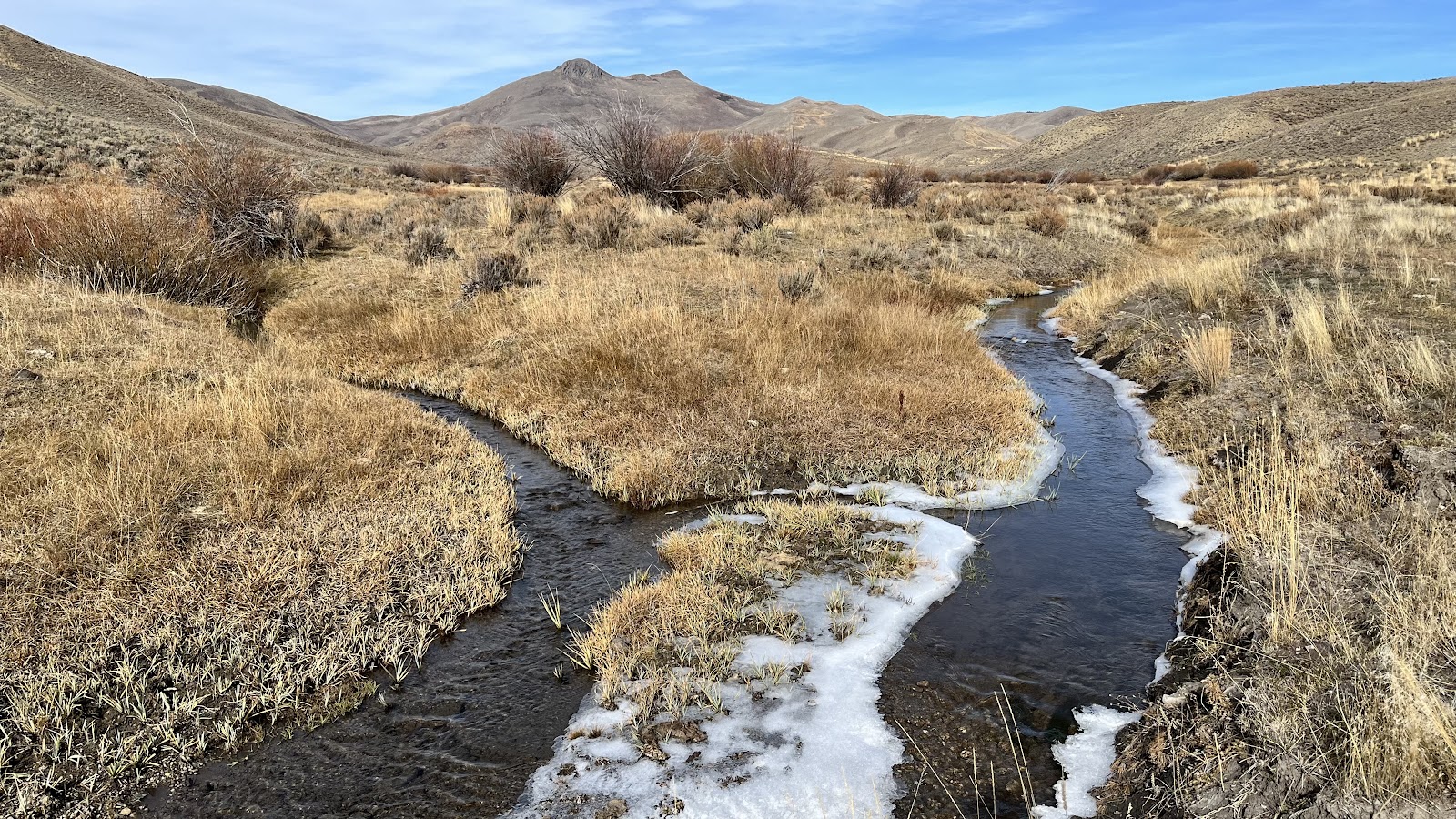
Wildcat Creek, once highlighted in older Utah Cutthroat Slam media, has faced challenges in recent years. Due to low water levels and past wildfires, its ability to support cutthroat has diminished significantly. Surveys in 2022 reveal only a handful of fish remaining, with some vital pools for winter survival having been washed out or silted in. Accessing the creek involves navigating a rougher, and more rutted-out dirt road, which can become particularly slippery and challenging after wet weather. A sturdy vehicle with good tires is advisable. One notable feature of this creek is the pond that lies near the bottom where the National Forest begins (41.924667, -113.598377). When full, it looks like ideal fish habitat, but trout are seldom found there. It’s best to try fishing starting above the pond area. Despite reports of Wildcat Creek being a “stronghold for fish” in the past, the creek’s flow has become highly unpredictable since the wildfires, as seen by the pond fluctuating between full to dry, year to year. Wildcat Creek itself, similar to Onemile Creek, is small and brushy. The Slam suggests fishing in the headwaters downstream from the two forks (41.902505, -113.618006). For additional guidance, the Slam website provides a link to Avenza Maps to download a free YCT map. The map offers highlighted fishing areas and detailed driving/parking instructions, which are especially useful for first-time visitors of the Raft Rivers.
I have visited Wildcat Creek multiple times over the years and it wasn’t until my most recent visit in the Spring of 2026 that I saw my first signs of life there and finally caught a Yellowstone cutthroat. I discovered some brand new beaver ponds along the creek and it was there and in the creek above that I began to see trout. This is one of the most challenging creeks in the Raft Rivers to fish from my experience, so if you find Onemile Creek enough of a challenge, you may want to pass on this location.

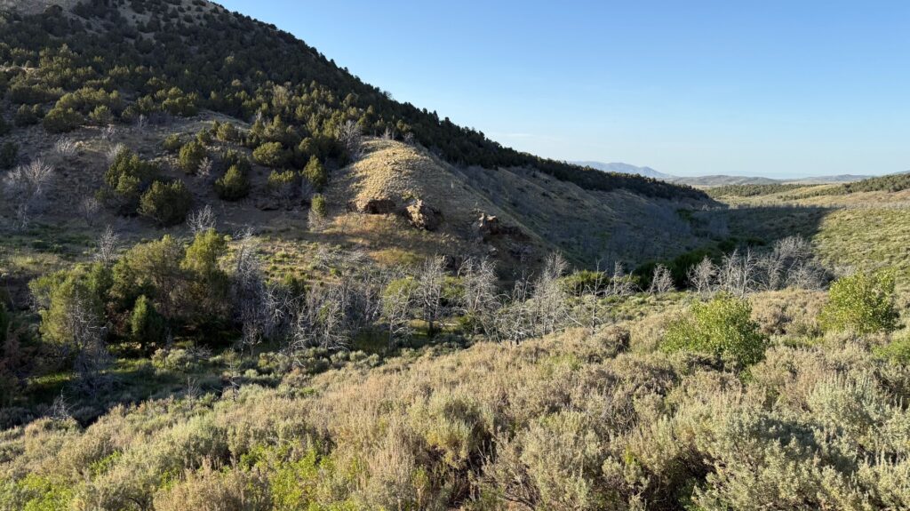
A view showing the small nature of Wildcat Creek and some of the nearby burnt trees (2023) – Photo by Hayden Cook 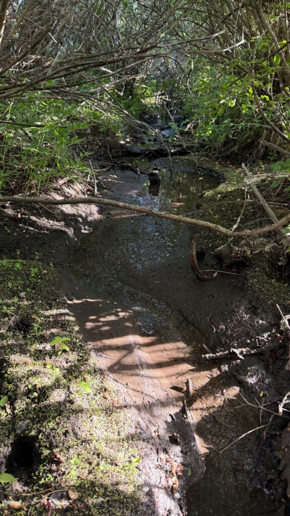
This visit to Wildcat Creek revealed extremely low flows and no signs of trout, but evidence of higher spring runoff was still visible (Late June 2025) – Photo by Hayden Cook
2022 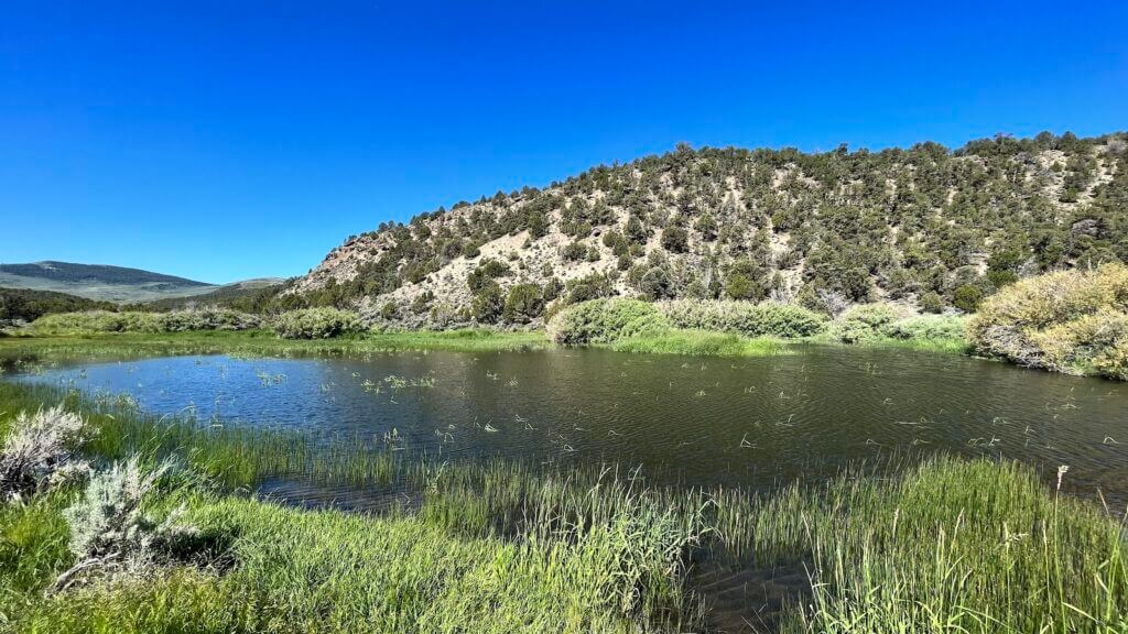
2023 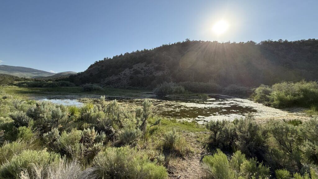
2025
Possibly my favorite of all the YCT creeks is George Creek. It’s a bit different from the others on this list because you can’t simply drive up to it on a regular dirt road. Getting there is a bit of a challenge. You could drive to the top of the tributary (41.915790, -113.419251) and hike down into the canyon, but you’ll definitely want a higher clearance 4×4 to get there, and it’s a tougher hike without an established trail. The fish don’t start appearing until a little ways below the confluence of the Cabin Spring tributary and George Creek, just to give an idea of where to expect fish to be. There is a small patch of private property near the headwaters along the creek with “No Trespassing” signs posted, so you may have to navigate around this parcel to continue fishing. I don’t generally recommend taking this route for George Creek unless you’re up for the challenge.
To access George Creek from the bottom of the drainage is also a challenge. The lower few miles of creek flow through private land, which is fenced-off and unaccessible. So to reach the National Forest where the public access begins, you must either hike in along the fence line or drive in via a rudimentary, off-camber ATV trail (which is manageable on an ATV or side by side). Once you reach George Creek where it becomes National Forest (41.920960, -113.484578), you’ll probably find many non-native rainbow trout, which were introduced long ago. They’re very common in the first few miles of stream, and I’ve even seen lots of hybridization between cutthroat and rainbows here as well. The Slam requires individuals to submit pure cutthroat for their slams, no cutthroat x rainbow hybrids (cutbows) are allowed, so you’ll want to head further up the canyon to reach the areas where pure YCT reside. Just be on the lookout for signs of hybridization (ie: white tipped fins, non-cutthroat spotting patterns, silvery coloring with a pink lateral stripe, etc.)
If you hike up the canyon far enough you will eventually find a huge log jam resulting from an avalanche long ago. This log jam acts as a natural barrier and it is believed that trout above this point are pure Yellowstones. Though I’ve caught pure-looking cutthroat below the barrier, if you want to be sure, hiking above this log jam and catching your cutthroat from there is your safest bet. With a somewhat established trail up the canyon from the bottom, should you decide to hike and fish your way up, it makes getting your pure YCT not too bad. Despite the creek being difficult to access, what George Creek does have going for it is its stunning scenery. The aspen and pine tree forest found here makes you feel like you’re in a totally different mountain range, and there are even spots where you can cast normally. It might not be the easiest place for beginners to start their slam, but for those looking for an adventure, it’s definitely worth exploring. Again, be careful of hybrid cutbows, and be wary of stinging nettle plants (ask me how I know!)


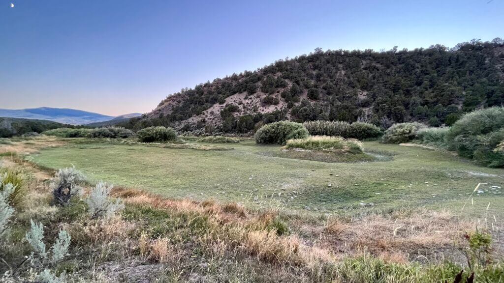
Basin Creek, located in the Raft River Mountains, is unique due to its flows still connecting to the Raft River via the South Fork of Junction Creek, and it is home to a good population of YCT. It’s the most distant creek to reach from I-84, which deters most travelers. Currently, the only accessible area of Basin Creek is technically on private property, though there are no gates or fences barring access. The Utah Cutthroat Slam is working to secure official angler access from landowners, but until then, fishing in Basin Creek or its tributary Mahogany Creek is not advised as anglers risk prosecution for trespassing. What Basin Creek does offer though is a decent dirt road making access simple, and the creek itself meanders through an open meadow which offers a different style of fishing than the other overgrown creeks on this list. The population of this creek in recent years has also suffered due to unknown causes, but currently a multi-year project is underway on both Basin Creek and the South Fork Junction Creek to reconnect the waterway. The project aims to remove old water diversions that are impassible to trout, and to remove invasive brown trout from lower portions of South Fork Junction Creek as well as upper portions of the Raft River itself. When completed, this will provide 27 miles of habitat for native YCT water in the Raft Rivers, as well as for native bluenose suckers. But again, we cannot truly recommend travelling to and fishing here until official angler access is secured.
And finally, we conclude this list of YCT waters with Clear Creek. If you’re driving to the Raft River Mountains from I-84, you’ll spot signage for the Clear Creek Campground along the way. Situated right by Clear Creek, this campground (41.954101, -113.319662) boasts some of the best flows among all the creeks in the region. However, the lower parts of Clear Creek are home to non-native brook and rainbow trout, which can reach pretty decent sizes! If you’re looking for a camping spot with picnic tables, pit restrooms, and fish to catch for dinner, this campground is perfect. But if you’re after YCT, you’ll need to travel up to the headwaters. Unfortunately, you cannot simply drive up the canyon and follow the river to reach them, as you’ll be met with a closed gate and “Private Property” signs. There is however a way to access the creek from the mountain top, similar to how one would access the headwaters of George Creek, so to the dedicated adventurer with a suitable off-road vehicle, this creek may be a viable option. The YCT population here has dwindled over the past decade, but trout are still present and catchable. Plus you’ll be rewarded with a beautiful pine and aspen forest situated in the narrow canyon the creek runs down.
miss. – Photo by Hayden Cook
That covers all the creeks in this region which host native Yellowstone cutthroat trout populations. Now, let’s offer some tips for traveling to this remote area. Ensure your vehicle is fueled up before entering the Raft River region, I recommend topping off in Snowville. Pack plenty of water, food, and emergency supplies in case of accidents or in the event that you become stranded. Cell service is sparse, especially off the main dirt road paralleling the Utah-Idaho border, so inform others of your whereabouts and return plans for safety. There are no fuel services in this remote area, so arrive prepared. A spare tire may not be a bad idea either, you’ll mostly be travelling on gravel and dirt roads, so a puncture out here isn’t out of the question.
For the Utah Cutthroat Slam, remember that Yellowstones must be caught in their native range to count. Historically YCT were stocked in Utah waters outside the Raft River range, like Electric Lake. But as this lake and others lie outside of the YCT native range, cutthroat caught there do not count for the slam. Lastly, anglers unfamiliar with the area should contact the DWR Northern Region Office at (801-476-2740) for updated information about conditions and other advice before heading out to these creeks. Good luck in your travels, tight lines, and we hope you enjoy the Utah Cutthroat Slam! The Raft Rivers become a favorite hidden gem for many after completing their Slam, so we hope you enjoy the adventure.
Destiny Densley
Posted at 18:52h, 30 DecemberMany of these Creeks in the Raft River Drainage are closer to Grouse Creek than Snowville and if you forget to top off your gas tanks.. Gas can be purchased at a self service pump in Grouse Creek that functions 24/7. There is a small Country Grocery Store in Grouse Creek with simple daylight hours but closed on Sundays.
Barton D. Smith
Posted at 11:48h, 07 AprilThank you for your detailed write-up Hayden. Getting ready to do my first slam and the info you provided was very thorough.
Robert Williamson
Posted at 11:14h, 14 AprilI would imagine with the record low snows this year (2025-26) these little creeks will be nearly dry and very difficult to fish.
Roger Young
Posted at 16:17h, 21 MaySpent the day in the Raft River area (5/20/26). First timer. It was absolutely beautiful. Spent the most time on Onemile creek. I saw one 4″ fish.. Lots of fences. It was quite frustrating. Very thick brush. It was impossible to fish with my 8′ fly rod. Casting was impossible. Tried to find Johnson creek. What we found was quite a hike (I am old, so anything more than a block is quite a hike). We tried to access from two sides, without luck. We did not see anything that remotely looked like it could support a population of trout. Went over to Lynn Creek. We caught a 13″ Sucker, a 3 1/2″ Whitefish (perhaps a Redside Shiner) and a couple of Brown Trout – 7″ and 12″. We even drove up to Lynn Reservoir. No access to the lake and we did not see any obvious signs of fish. The trip was fun and beautiful, but mostly a disappointment when it came to finding the elusive Yellowstone Cutthroat Trout in Utah.
Hayden Cook
Posted at 11:08h, 24 JuneSorry to hear of your difficulties with finding the Yellowstone cutthroat out there. It indeed can be a challenge if you’re unfamiliar with the water or the area. Glad you caught some other fish though! I would recommend using the coordinates in this guide and on our Yellowstone cutthroat trout page so you can pinpoint where the cutthroat are for next time you make the trip. I personally use a 6’6” rod for those tight little creeks and I have to exercise patience when exploring the creek and place flies on any pool that looks like there could be a fish. You’d be surprised at how small, of water the trout need to survive out there! Johnson Creek would also still be my number 1 recommendation, especially for first timers.